What is AgroHelper Satellites?
AgroHelper Satellites is a web application that provides satellite imagery to farmers and their advisors.Our solution streams data from the Sentinel and Landsat satellites. It has global coverage at 10 to 20 meters spatial resolution.
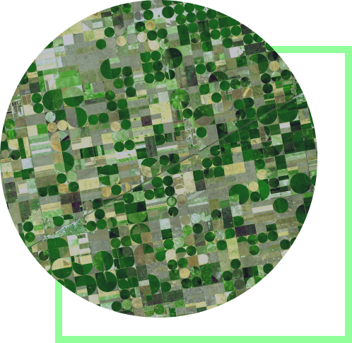
Global coverage at your fingertips
Images are available with approximately 5-day revisit frequency. Users can access a historical archive of images going back to March 2017 and to 2015 for certain European locations.
Get started with Agrohelper satellitesWorking with AgroHelper Satellites does not require any technical skills, initial set up, field boundaries or any other extra information. All you need to do is enter a location in the search bar, navigate to the specific region of interest (like you would do in any popular map application) and zoom in on any field. Once you have located the farming field, you can choose to view the image in:
- True/Natural color mode
- Agriculture mode
- NDVI
Use cases
AgroHelper is created to help farmers do their jobs more effectively with less effort. Our Web application can be used to:

Monitor plant growth and crop health
Detect biomass variability across the fields
Early pest and invasive species detection
Determine harvest time
Detect weeds growing on fallow fields
Assess storm damage