Today, thanks to innovations in digital technology and the satellites of the European Space Agency, farmers across the world can monitor their crops remotely.
Which are the most widely adopted use cases for satellite images in agriculture?
- Crop growth remote monitoring
- Monitoring of field-level productivity variations over time and definition of high/low productivity zones
- Moisture analysis
- Early pest and disease detection
What’s needed to start using satellite images in agriculture?
The images are accessible online. All the farmer needs, is a device (computer, laptop, tablet, or smartphone) and an internet connection.
How does it work?
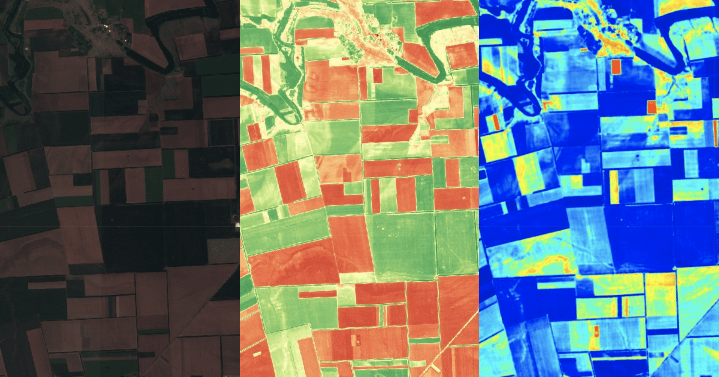
The satellites are equipped with multispectral sensors. The raw images are processed with different algorithms. The Normalized Difference Vegetation Index (NDVI) is one of the most effective tools that can detect the presence of chlorophyll, which correlates with plant health. You can learn more about it here.
The result is a plant health map allowing the farmers to monitor the state of their crops in near-real-time.
Agricultural producers can access new images of their fields every five days, depending on the cloud cover, as well as an image archive from 2017 until today.
For what types of crops is it working?
In theory, the technology could be used with all types of plants, as it measures the functioning of the photosynthesis process. In practice, we know that it works best on crops with dense canopy cover (i.e. wheat, potatoes, sunflower, corn, etc.).
For what agricultural holding sizes is this solution well suited?
Based on tests with images from the Sentinel Satellites, operated within the framework of the EU Copernicus mission, the monitoring is most effective on land parcels (blocks) of 10 hectares and more.
What’s the return on investment?
The investment is relatively low: 20 euros per month. Farmers start immediately to save money on fuel by optimizing their crop scouting efforts. This is just the beginning. The ability to detect crop health variability within the fields allows to use farming inputs rationally and spend money to treat only the areas that need it.
For example, producers can develop prescription zone maps for variable rate fertilizer application. In some cases, variable rate application may lead to an increase in fertilizer use in high productivity areas. However, farmers are benefiting from not applying too much fertilizer and seed to low productivity areas. According to a U.S. government report, this technique could generally lead to a 10% yield increase.
Last but not least, the solution could help farmers when investing to buy or rent land. The producer can verify the land parcel in the image archive going back to 2017 and see if there are any low productivity areas. This facilitates the price negotiations and strengthens the buyer position.

Mihail Marinov, co-founder at Agrohelper